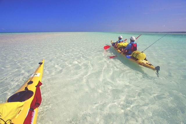
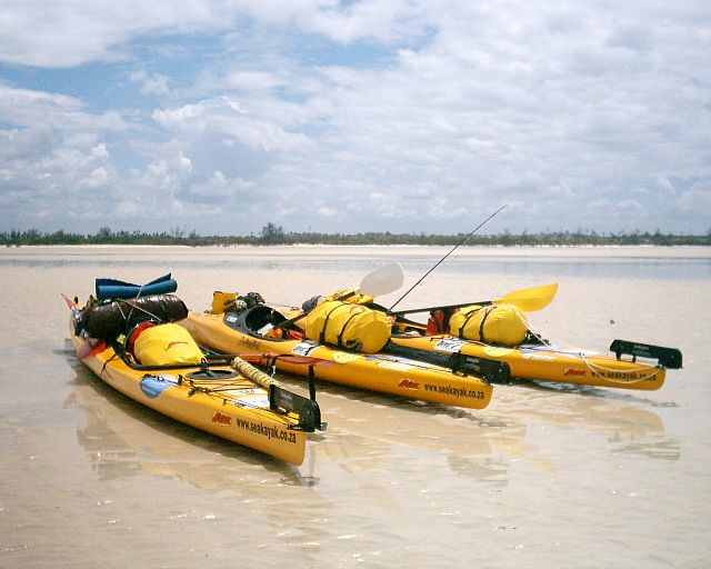
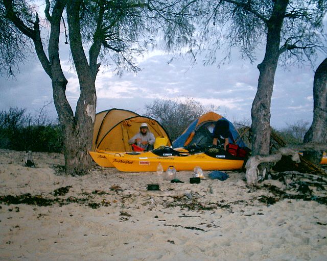
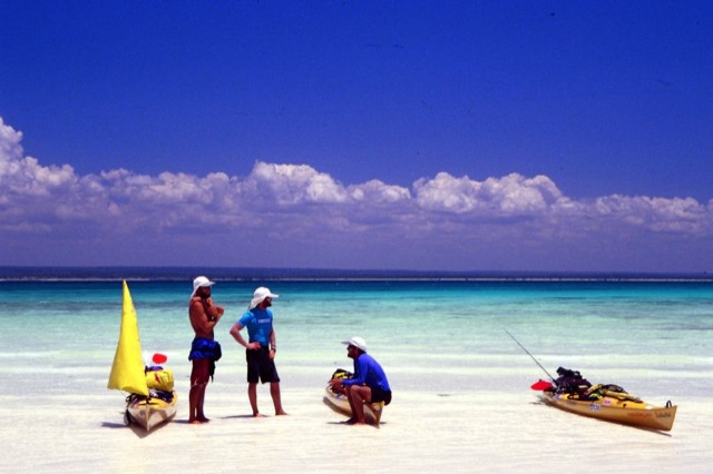
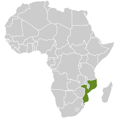
In 2003, four young adventurers set off to kayak down the entire coast of Mozambique, a distance of 2600km. Their journey (leaving from Cape Town, South Africa) took them four months and included a long overland journey to arrive in northern Mozambique.
These explorers’ pioneering adventure allowed them to meet locals (many of whom thought that this group of Mzungus (Swahili for ‘white people’) were quite mad) and to experience the fascinating sea life and conservation trials.
APE Tours:
APE Tours stands for Advanced Personal Expeditions. The company offers the ultimate service in adventure holiday planning. They aim to include aspects of culture, conservation and heritage in their tours – all while pursuing an outdoor adventure lifestyle. Groups are encouraged to create their own dream expedition and APE Tours will design and package everything from activities and transport to accommodation.
Every 18-24 months the company undertakes an epic sponsored expedition (such as kayaking down the Mozambique coast) with the aim of collecting information about various conservation, cultural and tourism developments. Through these efforts new destinations for future exploration and other commercial trips can be planned. Open Africa collaborates to establish Afrikatourism routes where appropriate conditions exist.
From the information gathered and experience gained on their Mozambique expedition, the intrepid kayaking team has identified two areas along that beautiful coastline suitable for the average paddler or for a family adventure:
- Ibo Island in the Quirimba Archipelago; and
- Ilha Bartholomeau Dias.
There two areas are the focus of this route.
Ibo Island, Quirimba Archipelago
Main Destinations:
Quissanga, Ilha do Ibo, Ilha Matemo, Ilha das Rolas, Ilha Macaloe and Pangane. Ibo Island will serve as a main base as it is situated about 10km from the coast and about 80km north of the provincial capital Pemba. It is about nine square kilometres in size.
Paddling Routes:
Although there is no recommended A to B route for paddling, the area has many day or overnight trips to explore. For all overnight excursions it is recommended that you take all your provisions with you, especially enough drinking water, sunscreen and maps.
The following are a few suggested excursions:
- Paddling from Bela Vista Lodge through the mangrove channel to Ilha Quirimba (You will need a guide to show you the way). Take note of the tides and also take mosquito repellent with you! The distance is roughly 15km one-way. From Ilha Quirimba, it is possible to kayak to Ilha Sencar for an overnight stay. Much of this route will become exposed with either mud flats or coral reefs at low tide so a tide timetable is an essential source of information.
- An overnight paddle to the island of Matemo (just north of Ilha do Ibo) is a great route of about 10km–12km. The inside section of the island has stunning little bays and sandy beaches to camp on. Be aware of the tides, especially in the main channel when crossing over from Ilha do Ibo, as the waters can become quite choppy.
- Another trip idea is a three-day paddle from Ilha do Ibo northwards past Ilha Matemo to Ilha das Rolas, a small beautiful conservation island just north west (roughly 25km) of Matemo Island.
- Day trips include paddling to the lighthouse on the seaward side of Ibo Island, roughly 6km on high tide and 10km on low tide. Paddling among the mangrove channels or fishing in the main channel are also options. A visit to Baixo de Sao Goncalo in the main channel, which becomes exposed at low tide, is also an exciting trip of roughly 6km.
Kayak fishing is a spectacular and fun way to catch yourself a wholesome fish for supper and if you are a fisherman by heart you will love the abundance of sealife, which include big kingfish, barracuda and mackerel in these waters.
How to get there:
The Quirimba Archipelago is situated in the far north of Mozambique. It stretches from the Mozambique/Tanzania border (Rio Rovuma) in the north to only 32km (20 miles) north of Pemba in the south. Pemba is the capital of the province of Cabo Delgado and provides most services expected in a small city.
To get to the Quirimba Archipelago one has to go through Pemba. You can fly in to the international airport in Pemba, but you will have to arrange to get your kayaks there by road, or arrange to rent them from either Pemba Beach Hotel or Bela Vista Lodge on Ibo Island.
From Pemba go back west on the main road, until you get to a small village called Sunate. Here take the good tar road north. About 83km north of Sunate take the gravel track down to Quissanga from where you will be able to board a dhow to get to Ibo Island.
Driving from South Africa:
This trip is possible to do in about five days if you are very serious about getting there quickly.
The suggested route to drive from South Africa (if you intend to get to Pemba as quickly as possible), is to drive through Zimbabwe and enter Mozambique at Mutare through the Beira Corridor. The road from Mutare to Beira is the EN6 and is not in bad condition. You pass through Chimoio, where it is recommended that you fill up with as much fuel as possible as the next available fuel is in Quelimane or Marromeu on the Zambezi side, if you take the 100km detour.
When you reach the crossroads with the EN1, take it northwards. This section of the EN1 is the best in the country, until you reach the Zambezi River. Here you have to cross on the pont, which may take a while as it is continuously breaking down and being repaired. There is an alternate route, which crosses the Zambezi over a long bridge and then a small pont 60km upstream at Vile de Sena, but the road is terrible and will take you an extra four hours to drive round and get back to the EN1.
From here to Quelimane the road is relatively good. The long stretch of road through Alto Molocue and to Nampula has sections of good road, but a lot of the bridges are destroyed and the bypasses may need a 4×4 vehicle in rainy season (Jan – April). There are also some long sections of badly corrugated gravel road. This stretch of road might take a good 20 hours to drive. The short section of road between Nampula and the small village of Namialo is very bad but has been under construction since September 2003. At Namialo turn left onto the good national road that takes you to Pemba.
Ilha do Ibo:
Ibo Island is an ancient town that was once a major slave trade centre. After the slave trade collapsed, so did the city. All that is left now are some beautiful but very dilapidated buildings. Some of the buildings have been renovated and turned into guesthouses, such as Bela Vista (which has the only running water on the island). It is possible to buy basic provisions on the island such as pasta, fruit, sugar, maize meal, beer and toiletries. Fresh water from boreholes is also available. There is a Telecommunicatos de Mozambique office where phone calls can be made.
The general pace of life on Ibo is slow and relaxed, offering an escape from reality and the rush of western life. Many of the women wear a white decorated facemask, which is known as musiro. It is intended to beautify the skin, making it softer and suppler and remove blemishes. It also serves as a local sun cream and consists of a paste made from crushed ximbuti branches. There is a great amount of bird life on the island, such as the Lilac-Breasted Roller, the Olive Bee-Eater, the Banded Martin, the Woodland Kingfisher and the Black-Crowned Night Heron.
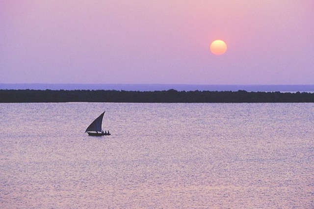
The most interesting craftsmanship on Ibo Island is the making of unique silver jewellery, fashioned in the traditional way by silversmiths (often disabled islanders who learn the trade from the elders). Observing them is well worth a few hours of your time. If you are really enterprising you can take along some old jewellery, or silver tablespoons and the silversmiths will turn them into the most delicate works of art while you watch. But beware, the silversmiths will melt down your offerings to test that they are really silver! You can also arrange a trip on a dhow for an unforgettable sailing experience.
History of Ibo Island:
The Portuguese arrived in the archipelago in the beginning of the l6th century, and it was fortified as early as 1609. When the Portuguese lost domination over the northern East African coast and the sea route to India in the 17th century, they were in search of new ports to sustain the trade on the Mozambican coast. The Quirimba archipelago naturally became one of them and by the late 18th century Ibo became the most important town in Mozambique after Ilha de Mozambique.
Ibo is the most well-known island in the Quirimba area. It is primarily an export point though Ibo was previously a slave trading post, boosted by the demands of French sugar plantation owners in Mauritius and elsewhere. Initially Quirimba Island was the capital of the archipelago but because of attacks from the Arab sultanate of Zanzibar the capital was moved to Ibo Island. By the late 19th century it served as headquarters for the Niassa Company which was later relocated to Pemba.
In 1791 the S Joao Baptista Fortress was constructed and in the beginning of the 19th century the two smaller fortresses St Antonio and S Jos were built. In 1891 the Cabo Delgado province became part of the Niassa Company, which maintained Ibo as its capital. But in 1929 the capital was transferred to Porto Amila (now Pemba).
The Quirimba Archipelago is rich in religious, commercial and residential ruins from this time of great economic activity. On Ibo the remains of the fortresses and the church interact together with the urban nucleus showing architectural influences from Arabia, Persia, India and Europe.
Ilha Bartholomeau Dias:
Main Destinations:
Nova Mombane, Ilha Bartholomeau Dias, Ponta Macovane, Inhassoro and the Bazaruto Archipelago.
Paddling Routes:
There are a few options open to kayakers in this region, depending on your skill level, fitness and time available.
Option 1:
For the less experienced paddlers and those not confident about paddling through waves and in the open ocean. Grade 3+.
Option 1
This route involves either paddling down and out to Ilha Bartholomeau Dias and then back up the same way to Nova Mombane, or continuing down the coast to Inhassoro.
From Nova Mombane there is a short 6km gravel track that takes you to a launching site at the head of one of the mangrove channels. It is possible to launch a small boat here too (If you want to have a support boat with you). You will need to organise a guide in Mombane who can guide you down the mangrove channels and out into the lagoon behind Ilha Bartholomeau Dias. There are many beautiful places to camp on white beaches where the mangroves give way to the sea.
The route through the mangroves to the sea is about 8km long. Ilha Bartholomeau Dias is visible from here and lies roughly 8km out across the lagoon in a south-eastly direction. There are many sandbanks exposed in the lagoon at low tide and some Casuarina trees in the middle of the island. Some local fishermen have shacks near here and there’s a well (2m hole in the ground) where perfectly good, fresh water can be obtained. The island is unspoilt and makes for a picture perfect tropical island camping experience. There are some small waves on the eastern side of the island to play in, and just to the south of the island are some coral reefs to explore.
From Ilha Bartholomeau Dias one can paddle south to Ponta Juma, where the Rio Govuro exits into the sea. It creates a large estuary that can be explored but beware of the strong tidal currents running near the mouth. From here it is another 35km down the coast to Inhassoro. The sea is generally calm along here as it has the protection of Bazaruto Island. A long red sand cliff rises up off the beach for most of the way down to Inhassoro. One can camp anywhere along this beach and there are few locals. Inhassoro is a small village that sees a lot of angling tourists visiting it for its proximity to excellent reefs, fishing grounds and suitable launch areas. It has a good campsite and some places to stay, as well as some well-stocked shops. It makes an excellent place for the driver of the pick-up car to relax and wait for the kayakers to arrive. You can either end the trip here or continue down along the coastline for another 50km to Vilanculos.
Option 2:
This is for the more experienced paddler who can handle paddling out through sizable surf and has a Grade 5+ grading.
Option 2:
Instead of taking the 6km gravel track from Nova Mombane to the head of the mangrove channel that leads of the lagoon, this route follows the Rio Save to the ocean and then follows the coastline south until one reaches the safety of the lagoon. Just downstream from Nova Mombane, the Rio Save splits into two streams that exit into the sea in two completely different places. The split is not very obvious at all as 99% of the water flows down the main channel that veers northwards. It is recommended that paddlers take the southern stream as it cuts out a huge distance. The entrance to this stream is roughly 1.5km east (downstream) of Nova Mombane and is the first small channel on the right that breaks away from the main river after leaving Nova Mombane. It starts off being barely wide enough and deep enough to paddle down but soon develops into a major river course that winds its way eastward towards the sea. The birdlife seen along the river is incredible.
At the mouth one may have to push out through some surf to gain access to the open ocean and then head south for about 7km before entering the same lagoon talked about in the route for Option 1. From here, the route to follow would be exactly the same as that described in Option 1.
Dangers:
- Getting lost in the mangrove channels is a very real possibility so having a local guide to paddle with you is highly recommended;
- Malaria is present in this area and prophylaxis should be taken;
- The area is very remote and chances of getting rescued out there are very slight. The resorts on Bazaruto Island might be able to assist you if you can obtain telecommunication with them. Bazaruto is only about 60km south east of Ilha Bartholomeau Dias;
- Swells around the southern mouth of the Rio Save can be big and there are often strong currents around Ilha Bartholomeau Dias; and
- The locals in this area are extremely friendly but care should still be taken with your possessions.
How to get there:
From Maputo take the EN1 north. After travelling 97km past the turnoff to Vilanculos take the turnoff to Nova Mombane. There is 42km of decent gravel road and this will take you to Nova Mombane. Only very basic supplies are available here. It is suggested that you take all your own provisions with you.
An interesting local man has a few small mud huts on the Rio Save that can be rented. Otherwise, just set up camp nearby. The manager has a small rubber duck with outboard engine available for hire if you wish to organise your own support for an outing.
Place description:
Nova Mombane is situated on the pristine Rio Save, which at this point is about 100m wide and flows like this all the way to the sea some 12km downstream. The water-birdlife is phenomenal and all the local fishermen transport goods and fish up and down the river in dugouts.
The Rio Save is the dividing line between two very different marine habitats. In the north (for about 1000km until one reaches Ilha de Mozambique), the sea is a muddy brown colour where large prawns thrive and the coast consists of sand and large mangrove swamps. In the south, the water is crystal clear and beautiful coral reefs thrive, along with all the big game fish found in these conditions. Inland there are still extensive mangrove systems with many channels to get lost in.
Ilha Bartholomeau Dias is a sand island situated about 8km offshore. It is covered with some Casuarina trees and low dune scrub. On the inside of the island is a huge turquoise lagoon area with some deep channels that get progressively shallower towards the mainland. The mainland coastline has huge mangrove swamps and beautiful long beaches. South of Ilha Bartholomeau Dias one rejoins the mainland – and here a red clay cliff rises directly above the beach and stretches all the way to Inhassoro.
Charts:
The British Admiralty chart, BA2932, covers the region from Sao Sebastian (south of Bazaruto) to Beira (1:300 000) and shows the paddling region sufficiently. This chart can be obtained from Chart World in Cape Town. The Portuguese chart of the same region can be obtained at the Maputo docks from the port captain. They are a lot cheaper than the British Admiralty version.
Note: the shape and position of Bartholomeau Dias Island has changed somewhat to how it is represented in the Portuguese map of 1984.

