The Augrabies Contrast Route is a land of contrasts. This arid zone, with its rugged mountains and desert-adapted species, is stifling hot in summer (up to 45ºC) and chilly in winter nights. The Great Gariep, known more commonly as the Orange River, winds through the landscape and brings it life. This river was once called ‘God’s gift to the Southern African thirstland‘. The greenbelt along the river’s banks contrasts sharply with the rising rocky cliffs. Irrigation schemes have stretched the greenbelt into the desert, making acres of vineyards and other agriculture possible. Ten percent of South Africa’s vineyards are found in the Orange River valley and southern Kalahari.
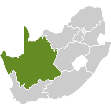
The Augrabies Contrast Route takes the traveller into one of the most interesting and beautiful areas of South Africa’s Northern Cape Province. The route forms a U-shape along both banks of the Orange River. The base of the “U” is the only place vehicles can cross the mighty waters. The largest town on the route, Kakamas, is also located here.
The Orange/Gariep River:
The Orange, or Gariep, River is the largest river in South Africa. Its source lies in the Drakensberg Mountains at Mont Aux Sources where the average annual rainfall regularly tops 2000mm. The Orange River flows westwards for 2 200km across South Africa, eventually creating the border between that country and Namibia, before it flows into the Atlantic Ocean at Alexander Bay. Interestingly, this area has an average annual rainfall of only 55mm.
The name ‘orange‘ comes from the river’s large silt load that makes the water look orange. From the air the outflow of the river into the Atlantic Ocean at Alexander Bay looks like a large orange fan spreading into the sea. The river’s traditional name, the Gariep means ‘great river’ – a name given by the original Khoisan inhabitants of the area.
The Vaal River joins the Orange at Douglas in the Northern Cape. In wet years the Orange and the Vaal can flood simultaneously, causing major flooding in the lower reaches. When it last flooded in 1988, its flow rate measured 7.8 million litres per second but it has risen to 11 million litres per second in the past. Dams have played a large role in determining the flow of the Orange. Before they were built, the river reduced to a trickle during the dry season, but the water regulations placed on the dams upriver now ensure a constant flow.
History of Kakamas:
There are several theories as to where the name Kakamas came from:
- Bad Grazing: Before the canals and irrigation schemes were built, the area was notorious for its poor grazing pastures;
- Angry, charging cow / chasing cows: This may derive from the Korana word kagamas, which could have become associated with the town because the river banks nearby had sloping banks making it an easy crossing place for cattle herds. Most herds were, of course, reluctant to enter the river, and would apparently turn on their herdsmen. Another interpretation is that a fierce buffalo cow stormed the herders when they were driving their cattle through the drift;
- Thakemas meaning “drink place”: This could refer to the ease with which cattle could be herded to the area to drink;
- “Swimming Water”: Possibly from the Bushman word, given to the place because it was possible to swim across the large river at this point.
Whatever the origin of its name, Kakamas developed as a town in the late 1800’s and early 1900’s. During this period of war and world depression the bitterly poor people from the surrounding areas came to the church in Kakamas for help. They were offered the option of trading their labour for food. Canals had already been built in the nearby town of Upington and a similar project was mooted for Kakamas. At a town called Neusberg (meaning ‘nose mountain’ as it looks like a nose), about 10km from Kakamas, it was found that the river’s course was such that, if a canal were built, the water would flow automatically, doing away with the need for pumps. Work began on the furrows. Men, women and children dug relentlessly using picks, shovels and their hands. It was said that the earth where they worked would turn into mud from their sweat. The people would often work at night to escape the intense heat of the day. Two canals or furrows, called the South and the North Canals, were eventually completed. During construction of the North Canal, however, it became obvious that two tunnels would have to be built to maintain a gradient that facilitated automatic water flow. Japie Lütz, from Upington, did the calculations and laid down the necessary measurements. The two tunnels were eventually completed. Amazingly they were both excavated from either side and met precisely. This impressive feat was achieved without the use of modern instruments. These hand-dug tunnels, one of them 160m long, are still in use and have been declared national monuments. A small settlement in the area, Lutzburg, is named after the self-trained engineer who ensured their usefulness.
Once the canals and tunnels had been excavated it was possible for the people to begin farming. A number of water wheels (some still in use today) were built to lift the water from the canals into pipes for distribution into the fields. The community began planting food crops and then expanded operations to include grapes. At first mostly raisin grapes were produced in the area. These days Kakamas is renowned for its seedless table grapes and wines. Because the area is so warm, the grapes ripen early and the crops can receive good prices in northern-hemisphere markets.
In the 1960s the state took over the control of the canals from the church. The land was divided and private people could acquire it. The first hydroelectric scheme in South Africa was also started in Kakamas – at a place where the North Canal dropped rapidly in elevation. This hydroelectric station is no longer working. However, the building at the scheme and the Egyptian-style transformer building in Kakamas town can still be visited. The two canals were eventually lined with cement in the 1990’s.
Interesting historical places to visit in the area include the old Egyptian-style transformer building in Kakamas, the hand-dug tunnels and canals, the water wheels and the German graves.
Many visitors find the marks left by the devastating floods of 1974 and 1988 particularly intriguing. Floods occur when it rains excessively in the Maluti and Drakensberg Mountains in the east and both the Vaal and Gariep Dams upstream overflow. Inhabitants tell sad tales of the fruit trees being swept away and many orchards decimated. The footbridge crossing the river above the Augrabies Falls was destroyed by floodwater and has not been rebuilt. A visit to the [Pienk Padstal] is recommended as this farm stall houses a flood-level marker and photographs of the floods.
The German graves:
The German graves date back to World War One. South Africa had been asked by the Allied forces to occupy the mainly German South West Africa (now Namibia) and cut off the Germans from the sea. In February 1915 a group of German soldiers came through the Kakamas area from the north in an attempt to stake a claim on the river crossing nearby. Unfortunately for them their recognisance information was incorrect and they were unaware of the approximately 2 000 South African troops waiting for them. Eight Germans were killed in the resulting battle. Documents recording the events claim that one of the eight shot himself as he was unable to drag his wounded body through the harsh heat to reach the river. The men were buried in shallow graves where they lay for many years. The bodies were exhumed in 1964 and some returned to Germany. The others were reburied just outside the town on the hill where they had fought and a monument erected in their memory.
Essential information:
“Here the local welcome is warmer than the sun on a quiver tree.”
The Augrabies Contrast Route route has something for everyone. In addition to visiting the popular Augrabies Falls visitors can relax in hot springs, river raft, go on 4×4 trips, hike, bird watch, sample local delicacies and wines, touch the unique Kokerboom (quiver tree) and even take a leisurely donkey cart ride through town – all while enjoying the friendly hospitality of South Africa’s Northern Cape province.
Accommodation options on the route range from camping and backpackers hostels to B&B’s, hotels and luxury chalets. Kakamas has banks and shops. Delightful farm stalls selling local dried fruit and other produce dot the sides of most of the roads.
Upington (80km from Kakamas) hosts a domestic airport with daily flights from both Johannesburg and Cape Town. Car hire is available at the airport. The weather is typical of most desert and semi-desert areas, with hot summers from October to March. Sun protection is essential. Winter temperatures may drop below freezing at night but the days are warm and pleasant.
We gratefully acknowledge the information and photographs sourced from the Augrabies Falls National Park Travel Guide and the participants on the Augrabies Contrast Route.